For those of you who are new to onX Offroad, or who have not used it for route planning much, we’ve pulled together a helpful selection of tutorial videos so you can get a “quick start” as you begin to plan your Overland Stages.
USING ONX OFFROAD TO PLAN
Once you know the general area you will be exploring, you can use onX to find appropriate trails. One of the great features of the software is that it not only shows you where the legal trails are, but it also gives you a lot of information on many of them — most importantly, it indicates if the trail is large enough for a Jeep or full-size overlander, or just wide enough for something smaller and it gives difficulty ratings and descriptions.
This short video shows you how to easily find trails in any area you want to explore:
Once you have a sense of what trails you may want to explore, you can also add in your own waypoints for things like campsites, scenic photo stops, hiking trail heads or other activities.
Another way onX helps in the route planning process is by clearly indicating who manages the land you will be using so that you can be sure to have the appropriate permits and know any specific regulations. And the app doesn’t only show public lands — it includes private land and trails in the various off-road parks, too.
This video shows you how the “land ownership” feature works:
And a great new feature that onX added for 2023 is the ability to build, save and share routes. Using this tool you can completely pre-plan your overland segments (and then follow that plan as you navigate out on the terrain.
This video shows you how the “route builder” feature works:
USING ONX OFFROAD TO NAVIGATE
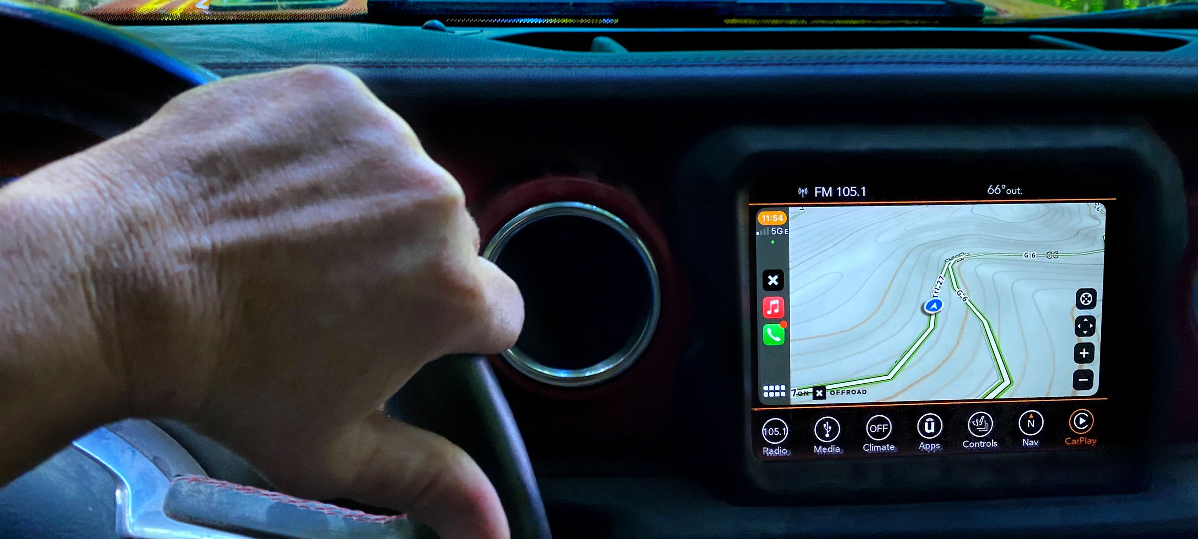
After you’ve determined the trails you want to run and set up any waypoints, you can use the app on your phone as a GPS navigational tool in your vehicle (it works with CarPlay and Android Auto so you can use it conveniently on your dash screen). But before you head out for remote areas where you might not have cell signal, you should make sure you download the off-line maps for the key regions you will be traveling in.
Once you have your maps downloaded to your phone, and you head out on the trail, you can use the app to record your track, make scouting notes, access weather info and to share your route or track recording with others.
This video gives a quick overview of how to use the app features on your phone while out on the trails:
And this video continues into some more of the advanced features:
Finally, as you are driving on the trails onX Offroad is fully integrated with Apple CarPlay and Android Auto, so you can use the GPS navigation screen directly on your dashboard (we didn’t find a short video about this, but here are the full how-to instructions from the onX site: for CarPlay, for Android Auto).
For more info about onX Offroad see their website or for information about what onX Maps is doing to support land access, see their news pages.