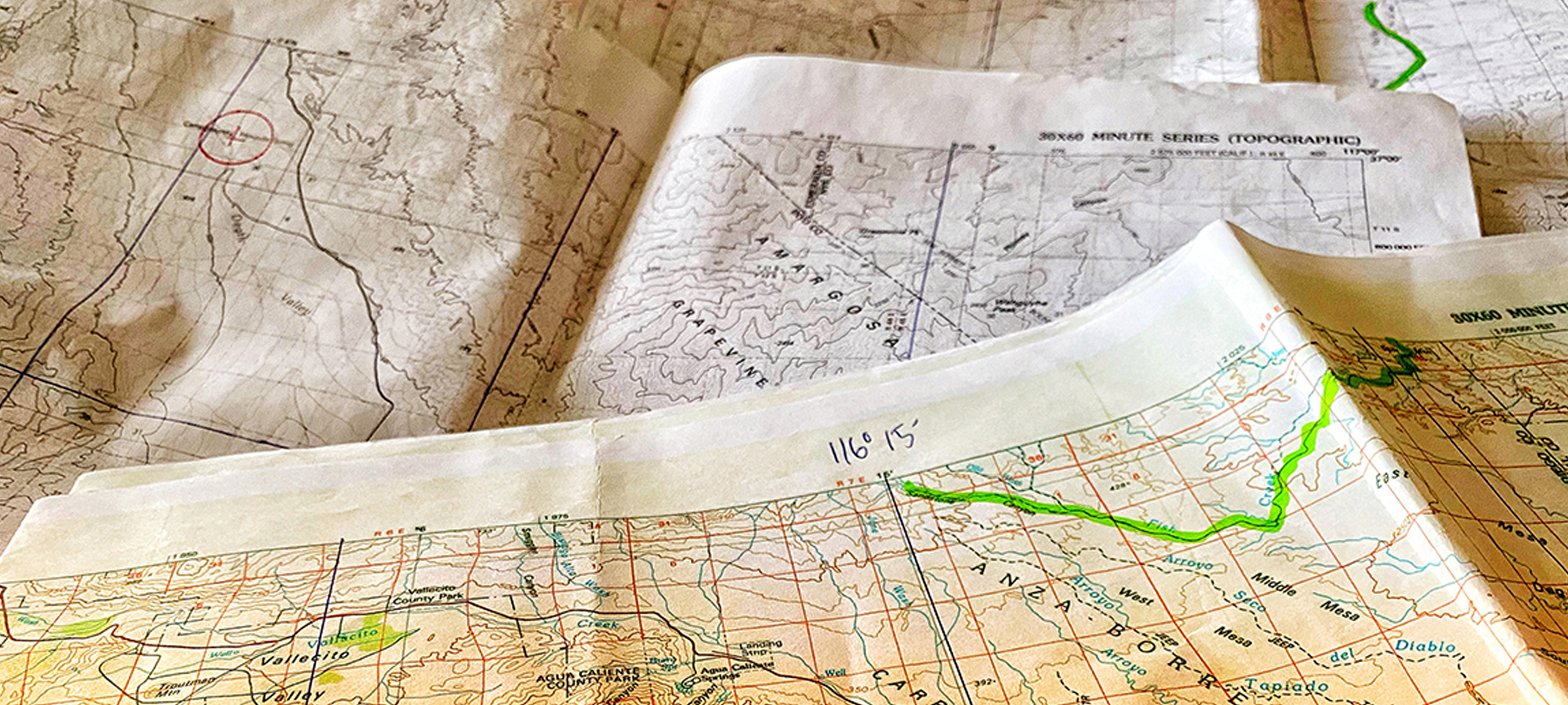
Depending on where you are traveling you may have different options for good quality paper maps to help you in your route planning and navigation. If you are purchasing maps, the National Geographic Trails Illustrated series of topographic maps is a good choice and they have a fairly large selection of popular destinations, however, if you are looking for different scale maps, or areas that are less “popular” you will probably want to source your topo maps online from the USGS or CalTopo, both of which have maps that cover the entirety of the USA in multiple scales.
USGS Maps
Using the Map Locator page, you can access topographic maps at various scales, and download them as PDFs for free (or you can order a paper copy if it is not urgent). These PDFs are full scale large maps, and will need to be printed at a business printing center, such as the kind you find in a Staples store. You can actually order your print directly online, and then just pick it up when it is ready usually within less than 24 hours (see details on ordering prints below).
Note that if you are downloading and printing maps from USGS and using the “older” maps (the free ones), your map datuum may not match the GPS/Google Maps datuum — this is not a problem for any ordinary navigation or anything you will need to be doing for the Nomad Overland Rally, but if you plan on doing extremely precise navigation exercises (for something like the Rebelle Rally or Rallye Aicha des Gazelles au Maroc), points plotted on these maps will be slightly “off” versus a GPS coordinate pulled off of Google Maps.
CALTOPO
CalTopo is a bit more complicated to use, but it allows you to make maps that cover the exact locations you want to include (versus the standard map sections you will find at USGS — sometimes you will need to print three or four maps for one location because the area you are intereseted in is on the edge of adjacent maps). CalTopo also makes it easy to print small map sections on your home printer on letter-size paper for free.
You can also make large maps with CalTopo if you subscribe to the Pro version for a $50 annual fee (if you are going to make a lot of paper maps and/or you need them to match the GPS/Google Maps datuums for precision navigation it is well worth the fee).
PRINTING LARGE MAPS
If you decide to print full scale maps, you will want to be sure to order them as “blueprints” rather than as “posters” because they will be much cheaper. You can order directly at a Staples store near you by using this link, and uploading your PDFs.
Follow these steps:
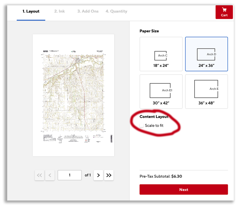
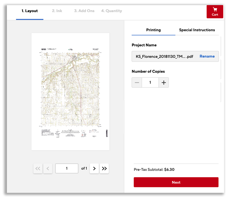
1. Click Start Project and upload your PDF. When the upload is complete click “continue” to access the dashboard.
2. Make sure “Scale to Fit” box is unchecked, then select the appropriate paper size for your map (the preview should show the entire map centered with the edges viewable — if you only see a closeup section of the map the paper size you chose is too small).
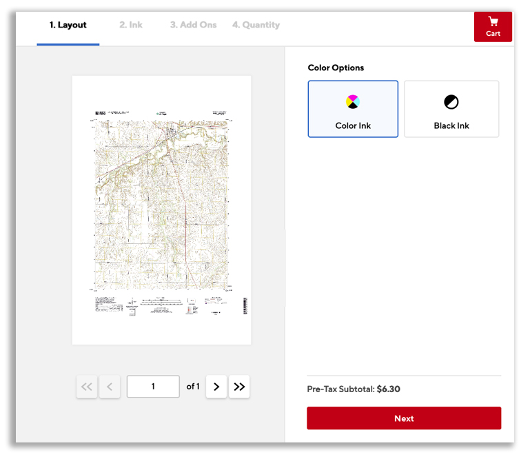
3. On Next screen, choose color or black and white (black and white is cheaper, but depending on what you are using the map for, and how comfortable you are reading topo maps, you might be best off if you choose color)
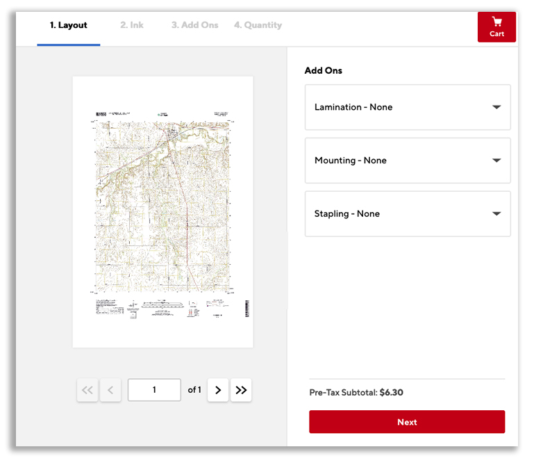
4. On Next screen you don’t need to choose any add ons.
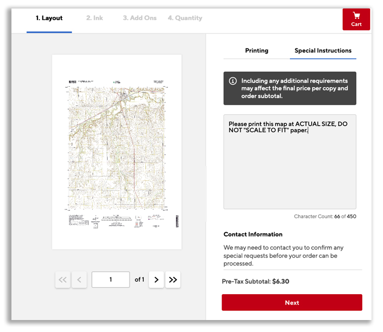
5. On the screen that asks for Project Name, click on the “Special Instructions” tab, and type in “Please print this map at ACTUAL SIZE, DO NOT “SCALE TO FIT” paper.” (because even though you made sure to “unclick” the “scale to fit” box, a busy store associate may print it as “scale to fit” anyway!)
6. Finish with the purchase/delivery/pickup information and complete your order.