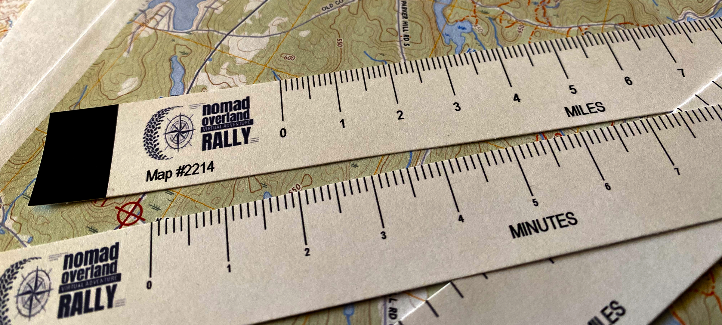
July 20, 2022 – USA: The sixth Weekly Challenge of the Nomad Overland Virtual Adventure Rally test the Teams’ skills at accurately plotting GPS coordinates on a paper map, interpreting the topo map and measuring distances. The competitors are given a set of latitude/longitude coordinates, the associated paper map, and a set of map rulers to scale for the specific map and must start the exercise by plotting all the points on the map.
Once they have done the plotting, they must respond to a series of questions about the locations of the points online, and measure the distances of specific routes. This Challenge checks the competitors’ precision and attention to detail, as well as their understanding of the basic mapping principles.
The Weekly Challenges are one of the four pillars of the Nomad Overland Virtual Adventure Rally and competitors can earn up to 100 points each week for completing the Challenge questions online. The Challenges also provide a way for all the teams to stay engaged over the whole ten weeks, even when they are not out exploring on Overland Stages. Each Week’s Challenge focuses on a different aspect of overland travel or outdoor skills — sometimes the competitors will have to do something offline in order to answer the questions and other times they just need to respond to multiple choice knowledge-checks. The teams are always free to research answers or find tutorials to help them complete the tasks prior to submitting their Challenges and once each Challenge “closes” they can consult the “correct” answers and explanations — turning it into a defacto learning opportunity.